
Lahore: Experts from Durham University, UK, and Al-Qadisiyyah University, Iraq, have successfully identified the true location of the famous Islamic battle, “The Battle of Qadisiyyah,” using images captured by American spy satellites.
This site, located near the city of Kufa on the Iraq-Saudi Arabia border, was photographed secretly by the U.S. satellite during the 1973 Arab-Israeli War and was declassified some time ago for research purposes.
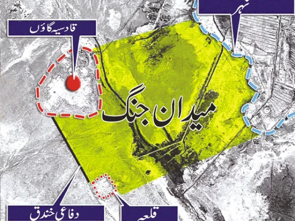
The experts were initially researching the famous route of the Hajj, “Darb al-Zubaydah,” leading from Iraq to Mecca. The images revealed clues from the writings of Arab historians about the Battle of Qadisiyyah, allowing researchers to pinpoint the battle’s location, which had been lost in the sands of time.
Iraqi experts then reached the site, which is now desolate, but they found signs of the battle, despite the absence of any settlements.
The decisive Battle of Qadisiyyah, fought in November 636 CE, was led by Caliph Umar ibn al-Khattab and General Sa’d ibn Abi Waqqas against the Persian Sassanid and Byzantine forces, led by the commander Rustam. The victory in this battle paved the way for the spread of Islam across Iraq, Iran, and India, marking it as a crucial event in early Islamic history.